
With over a decade of experience and state of the art equipment we are capable of any project.
Next time you need a survey contact Pine Ridge Land Surveying and discover the difference.
Pine Ridge Land Surveying FAQs
What is a land survey?
A land survey is performed for the purpose of locating, describing, monumenting and mapping the boundaries and corners of a parcel of land. It may also include mapping of the topography of the parcel, and the location of buildings or other improvements upon the parcel.
What is a boundary?
A boundary is any natural or artificial separation marking the border of two adjacent properties. A natural boundary is one existing in nature, such as a river; while an artificial boundary is one created by written conveyance such as the Public Land Survey System, Subdivisions or Deeds.
How are boundaries created?
Most boundaries are created by written documents (such as warranty or quit claim deeds) that contain specific descriptions. Property rights may also be established by unwritten means such as long time physical occupation of land. A Professional Land Surveyor will research these factors and how they affect the boundaries of your property.
What is a monument?
A monument is an object that marks a corner or an angle point in a property line. They can be natural monuments, such as the center of a creek or a tree; or, they can be man made, such as an iron pin, rebar, pipe, nail, buggy axle, etc
Who can perform a land survey?
The State of Wisconsin has laws requiring a registered land surveyor (RLS) to assume the legal responsibility of a land survey. The licensed surveyor is a highly specialized individual, whose education, experience, and competence have been formally examined and licensed by the state of Wisconsin. Their conduct and the quality of their work are subject to a defined code of ethics.
When should I have my land surveyed?
- Before you purchase it. This will disclose the relationship between the lines of possession and the deeded property lines.
- A lending institution may require either a Land Survey Plat or an Improvement Location Certificate of your property when you borrow money on it.
- Whenever you believe there may be a conflict of use on your property.
- Prior to dividing any parcel of land for sale.
- The county or city that your property is located in may require a Land Survey prior to the construction of any structure or improvement on the property.
- When you intend to sell any tract of land.
- When your lawyer, architect, real estate agent or municipal planning or engineering office advises or requires it.
How do I authorize a Land Survey?
Explain why you want the survey. The surveyor can then advise you as to what standards and type of survey is required. You should furnish the Professional Land Surveyor with a description of the property along with all other information or documents that you may have regarding the parcel. These would include abstracts of title, title reports, previous survey reports and maps, and the location of any corner monuments. The Professional Land Surveyor may request a retainer and written authorization to proceed prior to conducting the survey.
How much will a survey cost?
The Professional Land Surveyor's fees will be based on the anticipated difficulty and time required to complete the project. Routine survey projects may be estimated as to cost, but the client should be aware that in many situations, the Professional Land Surveyor cannot predict the amount of work that will be required to recover necessary monuments, restore lost or obliterated corners, research city and county records, collect field data, complete mathematical calculations, and prepare descriptions and maps of the property. All of this must be combined and analyzed to establish the location of property corners and create the final map.
One of the most uncertain and costly parts of the survey is the recovery of various types of monuments. It is important for land owners, contractors and the general public to be aware that the careless treatment and destruction of survey monuments adds time and cost to subsequent surveys. Competitive bidding for the lowest price does not necessarily protect the interests of the client, the public or the Professional Land Surveyor. The competency, reputation, education and experience of several surveyors should be considered.
I only need one or two corners (monuments) set. Why do you need to survey my entire property?
When a lot or parcel of land is surveyed, the surveyor is responsible for any accepted evidence or monuments. At a minimum, the surveyor will need to perform enough survey work to be certain that all the monuments accepted reflect the true location of your boundary. Therefore, in order to be certain that the monuments are in the correct locations, a full boundary analysis of your property is required
My neighbor just hired a private land surveyor to locate his property corners. The surveyor set pins in my yard, saying it is really my neighbors'. What can I do?
Hire a private surveyor to verify the accuracy of the neighbor's survey.
How long is a survey good for?
A survey is like a photograph of a piece of property. It is only accurate as long as the conditions upon and surrounding the property remain unchanged. State law sets the statutory limit for liability for surveyors. Finally, if you are borrowing money to finance the purchase of property, your lender may require a survey to have been made within a certain length of time.
Why does a survey cost what it does?
A proper boundary survey involves a thorough search of recorded documents and examination of physical evidence of prior surveys. The cost of a Land Survey is directly proportional to the total effort and time involved. When giving you an estimated proposal for services, the Land Surveyor estimates the cost for you based on many factors. Some of these are:
Accessibility:
Time to perform the fieldwork varies with the distance to, and the difficulty in reaching, the property corners necessary to complete the fieldwork.
Availability of Information and Records:
Record research can be affected by the amount of parcels involved, including the number of past transactions. (Often times land transactions have been handled poorly in the past, resulting in vague, incomplete, and often contradictory legal descriptions and deeds). The Land Surveyor's familiarity with the area may include the availability of records that the Land Surveyor has possession of.
Availability of Survey Monumentation and Evidence of Monumentation:
Iron, wood, or stone monuments, old fences or occupation lines, witness trees, and parole evidence (oral evidence - word of mouth) aid the Land Surveyor. Someone pointing out accepted occupation lines and monumentation can be an effective aid to the Land Surveyor, especially prior to the fieldwork. Absence of them may increase the difficulty in retracing the original survey.
Boundary and Occupation Problems or Disputed Property Lines: Complexity, Sectionalized Land, (PLS-Rectangular Survey System):
Property described in this manner may require a survey of the entire Section (± one square mile) in which the land being surveyed lies, regardless of the area of the parcel. In some cases, a survey of more than one section is required, depending on the location of the parcel, and available government (PLS) monumentation.
Improvements - Houses, Garages, Fences, Pavement, Etc.:
If improvement locations are required to be located, additional measurements are taken in the fieldwork. It is usually advisable that improvements are located and put on the Plat of Survey for future reference. A recommendation might be to have your house or garage “tied into” your property line, which will show the distances from the building corners to your property line. This will allow you to always find your property line near your buildings, or other improvements. Privacy fencing often restricts visibility, requiring the Land Surveyor to work around them by “traversing” the measurements.
Equipment required to perform the job:
If any specialized equipment is needed, this could increase the cost of the project.
Size of the Parcel:
An irregularly shaped parcel has more corners to monument than a rectangular parcel containing the same area. Be careful to not determine or place any special relationship factor between the size of the parcel and the cost of the Land Survey. This is not true in many cases, but many people often incorrectly equate a "small lot" with a "small price" of the Land Survey, and a "large parcel" with a "larger, or more expensive" price.
Time of Year and Weather Conditions:
Foliage can make fieldwork difficult in the summer. At times in the winter months, weather hinders accessibility to the site, as well as making it more difficult to work on the site. Winter snows also can hide field evidence under the snow.
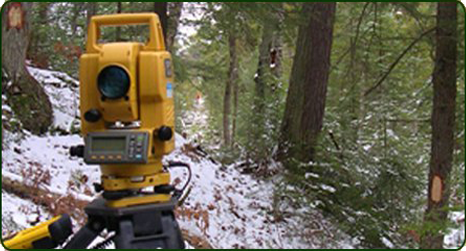
Topography, Terrain and Vegetation:
A level parcel of land is easier to survey than a mountain parcel. The Land Surveyor will usually ask if you would allow them to “clear a line” in wooded areas, or “brush” branches and small trees. This makes possible a line of sight for the fieldwork. Shrubs, flowers and trees on home sites are normally not disturbed, but might need additional fieldwork to work around them.
Type of Land Survey Required:
Costs may increase should the required precision and extent of the Land Survey increases. ALTA Land Surveys, and Title Company requirements may require considerably more documentation and fieldwork than is normally required by the average property owner.
How Long Does It Take To Do A Land Survey?
Generally speaking when the need for a survey arises, time is usually of an essence. This is often do to conflicts between land adjoiner’s, a house being built on the land, a real estate transaction taking place etc. Before a Land Surveyor can determine the location of boundary corners there is much work that needs to be done prior. The first step to almost all land surveying is obtaining copies of existing deeds. This usually includes the deed we’re surveying as well as the adjoining landowner’s deeds. We also need to research any prior surveys that have been completed in and around your area to look for any errors from prior surveys. If a lot of prior surveying has been done in and around your area this research may take several days. If no surveying has been done in your area this research could take considerably longer. Most surveys can be completed within 3 to 5 days once started. Given your circumstances, the Land Surveyor will gladly estimate how long the survey should take.
How Can I Tell What Has Been Surveyed?
All Professional Land Surveyors will place an acceptable monument at your boundary corners. This may be an iron pipe, or a rebar with a plastic cap on it stating the surveyor’s name and license number. The type and location of each corner will also be drawn on your survey map as well. We will normally “flag” the boundary lines with surveyor ribbon to show you the extents of your boundary.
Payment Options:
Cash, Check or Credit Card